Discover how we revolutionize the world of 3D scanning and virtual experiences with our state-of-the-art tools
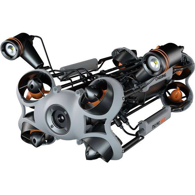
DRONE AND ROVER-ASSISTED SOLUTIONS
Our advanced drone and underwater rover technology enables us to capture aerial and aquatic data with unprecedented precision and efficiency. With high-resolution imaging, stable flight capabilities, and innovative underwater exploration features, our drones and rovers offer a powerful solution for technical inspections, photogrammetry, and visual capture. By integrating aerial and underwater perspectives, we improve safety, reduce costs, and enhance decision-making, catering to a wide range of industries and applications
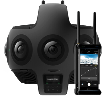
Immersive 360 Cameras
Our state-of-the-art 360 cameras capture every angle of your space, creating seamless, interactive virtual tours that allow users to explore properties and commercial spaces with ease. With high-quality imagery and intuitive navigation, our virtual tours provide an engaging, immersive experience that brings your space to life.
Advanced 3D Scanning
Our cutting-edge 3D scanners capture highly accurate and detailed data, transforming physical objects into precise digital twins. With applications ranging from product design to documentation, our 3D scanning technology streamlines workflows, enhances productivity, and provides unparalleled accuracy in creating true-to-life digital models.
AI-Powered Image Processing
We leverage artificial intelligence and advanced algorithms to process captured data, resulting in stunning virtual tours, highly accurate 3D models, and comprehensive inspection reports. Our AI-driven image processing enhances the quality and efficiency of our services, delivering exceptional results to our clients and partners
cloud
Opening up new possibilities in data visualization and analysis
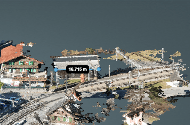
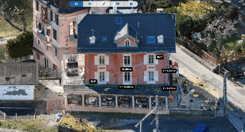
What opportunities does the point cloud provide for measurements?
The АС cloud allows you to make accurate measurements of distances, areas and volumes directly in the 3D model. It is especially useful in construction and architecture for planning and reviewing projects.
Can point cloud be used with virtual reality (VR) technology?
Yes, point clouds can be integrated with VR to create immersive, interactive 3D visualizations. This allows users to “walk” through their projects in virtual reality, which is especially useful in design and architecture.
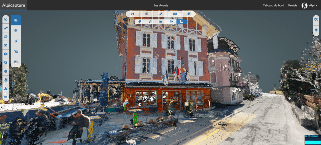
Features of AC platform
new level of interaction with 3D models
Easier Exchange
Share your point clouds with colleagues and external partners directly from your browser
Spherical image visualization
360 degree image visualization for full spatial perception
Accurate Visualization
High-quality display of 3D models with detailed visualization of textures and structures.
Security
Reliable and secure storage of your projects with convenient access and effective data management.
Automatic backup
Ac cloud allows you to automatically save the progress of your analyzes on your online projects.
Multiple Formats Support
Import and export data in a wide range of popular 3D modeling formats.
availability
Work with 3D data anywhere and from any device, without the need for complex installations.
Multilingual Support for Global Access
supports FR, EN, ES, IT, DE, JP on our platform for a seamless global experience
How to represent an interactive model using a point cloud?
Using AC software you can create an interactive 3D model based on a point cloud. Such models can be rotated, scaled and examined in detail, providing a deep understanding of the structure and space of an object.
Who is interested in point cloud technology?
Point cloud technology has applications in various fields including architecture, construction, surveying, archaeology, manufacturing, and even in the entertainment industry to create realistic 3D models.
What functions does the AC cloud offer for working with point clouds?
The program offers more than 50 different functions, which include data manipulation, measurements, modification and animation creation. Users can perform detailed model comparisons, as well as advanced tools for analyzing and visualizing 3D data, making it a powerful tool for professionals in a variety of fields.